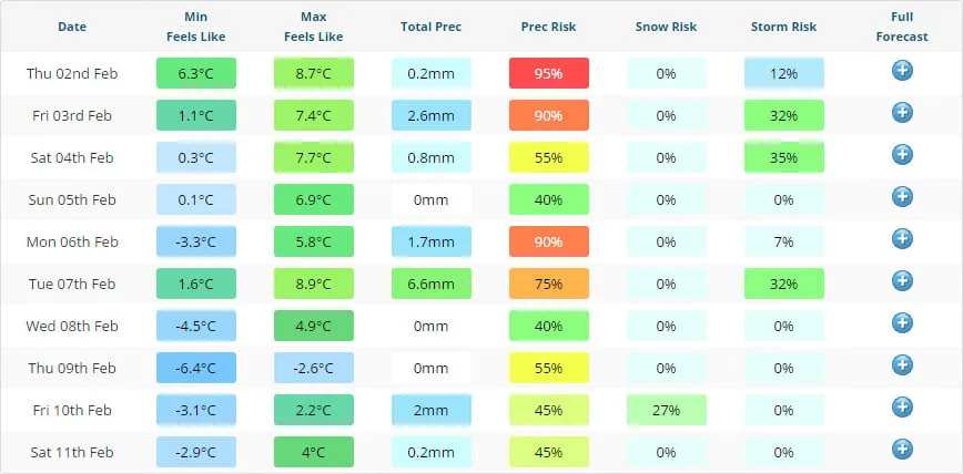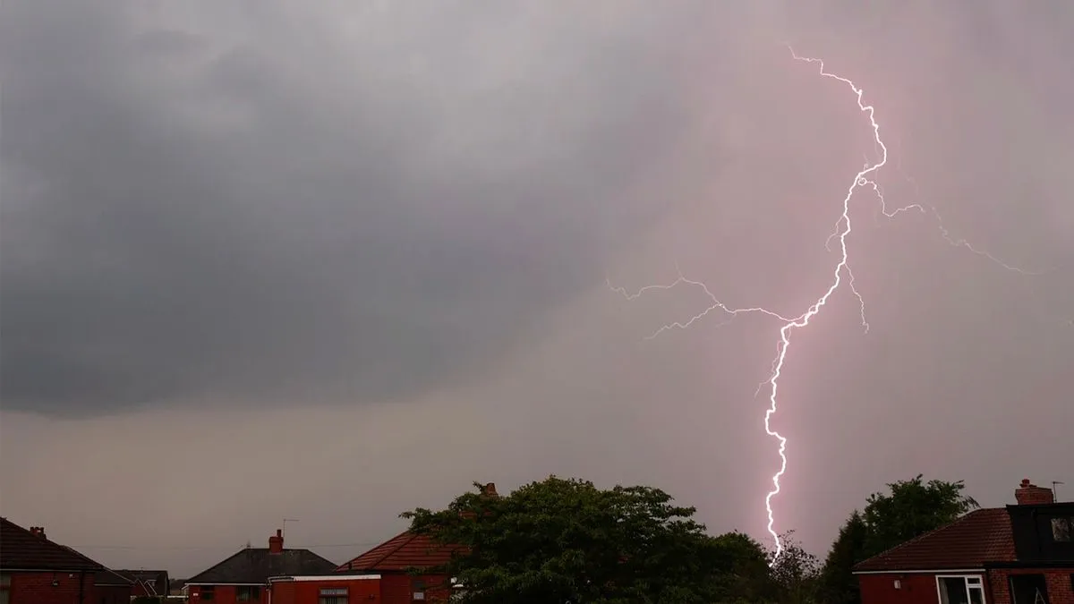
Thunderstorms are set to disrupt the Bank Holiday weekend across 22 counties in the UK, following a period of warm weather. The Met Office warns of heavy showers and possible hail.
As of early Tuesday, temperatures reached highs of 26 degrees Celsius earlier in the week. Now, predictions indicate a drop to between 17 and 19 degrees Celsius during the day.
The Met Office reported that thunderstorms were expected on May 3, 2026. This weather event is anticipated to impact many areas of England and Wales.
Key details:
- 22 counties are forecasted to experience thunderstorms.
- Hail and thunder are possible in parts of England and Wales.
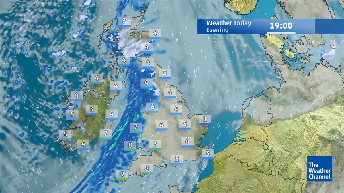
- The weather mapping service Ventusky predicts storms around 7 PM.
- Northeast England and southern Scotland will see wet conditions early in the day.
The Met Office advised people to avoid using landlines during thunderstorms due to lightning risks. Mark Sidaway, a deputy chief forecaster, stated that it would remain changeable with lingering cloud and scattered showers.
Officials have not confirmed the precise timing of all storm events. The Bank Holiday weekend is expected to bring a mixed weather picture with both showers and thunderstorms across the regions.